3.8.1 Uploading a Map Symbol

Starting with Oracle Spatial Studio version 23.2.0, you can upload custom map symbols (or icons) and also 3D models (in .glb format), which you can use in a Map or Cesium-Map visualization.

Note that only a user with the administrator role can upload the map symbols. However, once uploaded, all the other users can access and use them in their own projects. The following steps enable you to add a custom map symbol in Spatial Studio.

  1. Navigate to the Administration page.
  2. Click Map symbols under Settings.
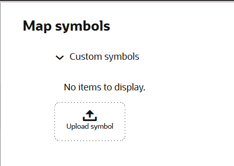
    The Map symbols slider opens as shown.

    Figure 3-44 Uploading a Map Symbol

    Description of Figure 3-44 follows
    Description of "Figure 3-44 Uploading a Map Symbol"
  3. Click the Custom symbols collapse icon and click Upload symbol.
  4. Select the required image file in your system for the upload.
    It is important to note the following:
    • Only .png, .gif, .jpg, and .glb file formats are supported.
    • Each file cannot exceed 2 MB in size.
  5. Optionally, change the Symbol name.
  6. Click submit_icon to add the custom map symbol.
    Once it is uploaded, you can style your data points on a map visualization using the new symbol. See Applying Custom Map Symbols to a Map Layer for more information.