3 Using Oracle Spatial Studio
Using Oracle Spatial Studio, you can create one or more projects, each of which can define one or more spatial datasets on which you can perform various spatial operations.
It is important you understand the following terminologies when working on Spatial Studio:
- A project contains Spatial Studio objects, such as datasets, that are logically related to some intended usage. For example, a project might be named New England Sales Territories, or Sales Territories and Customers, or Ohio Airports and Counties. When creating a project, you should know the purposes for which you want to identify and analyze spatial data in a geographic area.
- A dataset is a collection of spatial features of a specific usage type and geometry type. For example, datasets might include Airports represented by polygon geometries, or Roadways represented by LRS line string geometries, or Accidents represented by point geometries.
- A connection specifies information for connecting to an Oracle Database schema where spatial data of interest resides: user name, password, system, port, database name, and so on. (It is similar to a SQL Developer connection.)
Note:
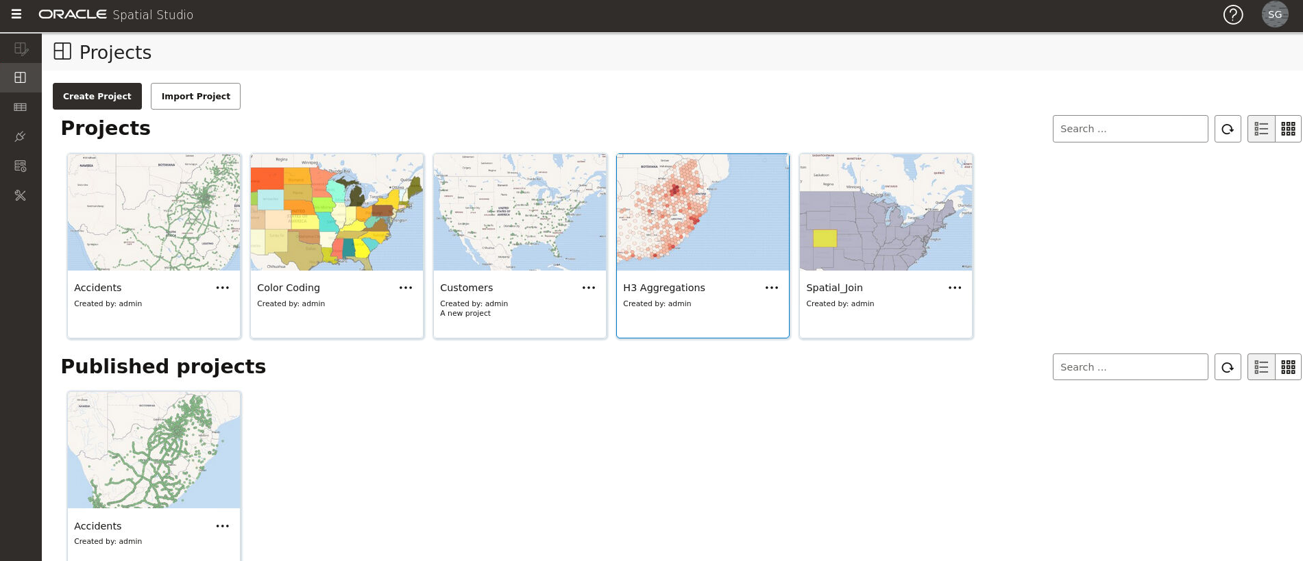
See also Spatial Studio Terminology for more information.The main landing page for Spatial Studio for a new user is as shown:
The overall layout of the Spatial Studio user interface comprises of:
- Header: The header at the top of the page contains the following
buttons:
 : to display or hide the side navigation menu
 : to help you get started on Spatial Studio by providing an overview of the tool and links to
other tutorial resources
 : displays the user profile details
- Side Navigation Menu: A navigation panel on the left displays the menu items. You can expand or collapse the navigation drawer.
- User Workspace: The page specific details for the selected menu option is displayed on the right.
The navigation menu consists of the following menu options:
- Active Project: Directs you to the Active Project page where your recent working project is displayed.
- Projects: Directs you to the Projects page where all your existing projects and published projects are listed.
- Datasets: Directs you to the Datasets page where all the datasets available to you are listed.
- Connections: Directs you to the Connections page where all the existing connections (data sources) available to you are listed.
- Jobs: Directs you to the Jobs page where the various background jobs started by Spatial Studio to process various requests are listed.
- Administration: Directs you to the Administration page where you can monitor the status and activity of Spatial Studio. It contains tabs for Settings, Maintenance, and Monitoring.
- Logging in to Spatial Studio
Once you have installed Spatial Studio, either as a standalone tool (Quick Start) or as a Java EE deployment, you can log in to the application. - Getting Started Using Spatial Studio
Spatial Studio includes a page with information and links to help you get started using the tool. - About Tokens in Spatial Studio
Spatial Studio allows you to create different types of access tokens. In addition, starting from Release 23.2.1, a system generated access-generator token is supported for each Spatial Studio user. - Spatial Studio Active Project Page
The Active Project page displays your current working project. - Spatial Studio Projects Page
The Projects page lists all the projects that have been created, both unpublished and published. - Spatial Studio Datasets Page
The Datasets page lets you view and edit existing datasets, and also create new ones. - Spatial Studio Connections Page
The Connections page displays all the existing connections and also allows you to create a new connection. - Spatial Studio Administration Page
You can monitor the status and activity of Spatial Studio in the Administration Page. You can also view server logs, change global system configurations, manage custom basemaps, and configure safe domains. - Spatial Studio Jobs Page
The Jobs page displays details of all the background jobs that run in Spatial Studio. - Visualization in Oracle Spatial Studio
You can visualize your spatial data in Oracle Spatial Studio using different modes of visualization. - Performing Analyses in Spatial Studio
You can perform various spatial analyses (such as filtering by proximity, nearest neighbor analysis and so on) and visualize the results in Spatial Studio.
