3.6.4 Geocoding a Dataset
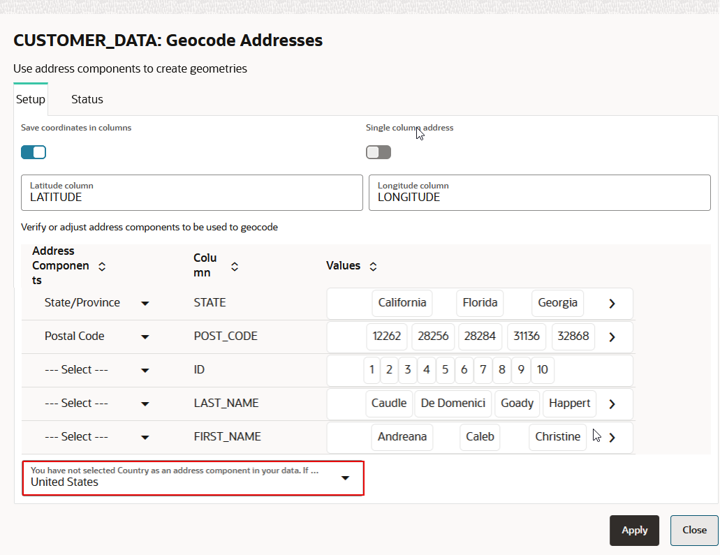
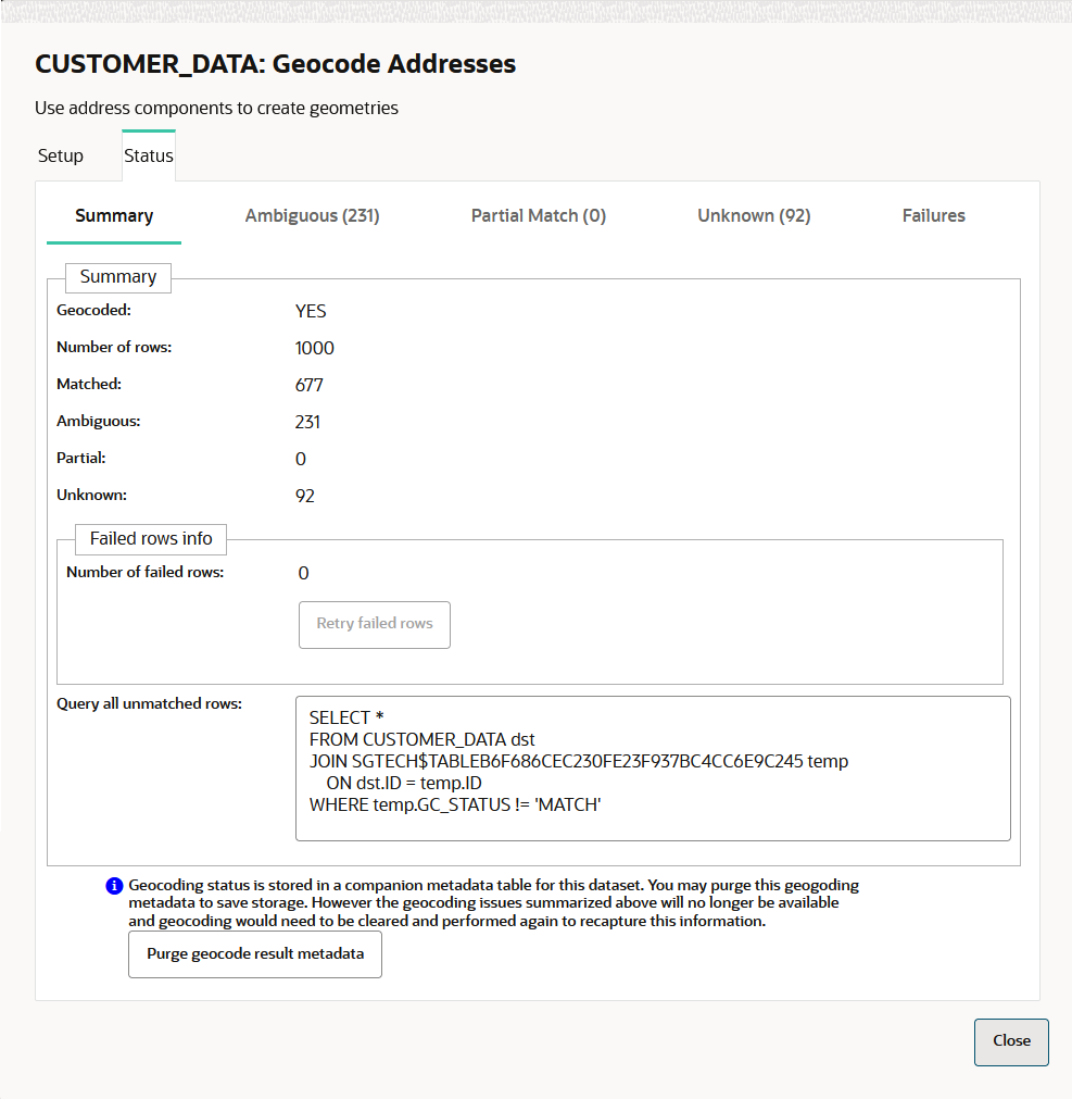
Geocoding is the process of deriving the latitude and longitude coordinates from location details that are geo address types.
You can geocode a dataset in Spatial Studio to store the resulting latitude and longitude information as a
SDO_GEOMETRY column. Optionally, you can also store them in
latitude and longitude numeric columns in the underlying database table referenced
by the dataset.
Prior to geocoding a dataset, if the Spatial Studio server is running behind a firewall, then ensure you have the correct Web Proxy information configured in the Console page. This is because the Spatial Studio application uses an external Oracle hosted geocoding service which is on the public internet.
You can perform the following steps to geocode a dataset.
Parent topic: Spatial Studio Datasets Page

