Synchronize ArcGIS Features as Activities in Oracle Field Service

The ArcGIS (ESRI) Adapter provides seamless synchronization of features created in ArcGIS to appear as activities in Oracle Field Service, ensuring a consistent data mapping and workflow integration.

This use case provides an overview of creating features with REST-based integrations with multiple invoke connections in ArcGIS and subsequently reflecting the same feature as an activity in Oracle Field Service.

The following adapters and their operations are used in this use case:

  • ArcGIS (ESRI) Adapter trigger connection: Captures the feature creation event in ArcGIS and triggers the integration.
  • REST Adapter invoke connections:
    • Extract Changes: Tracks changes in ArcGIS.
    • Status URL: Checks the status of the feature creation.
    • Result URL: Retrieves complete feature details, including object ID, geometry, and more.

This implementation pattern provides an overview of the steps.
  1. Create an ArcGIS (ESRI) Adapter trigger connection and REST Adapter and Oracle Field Service Cloud Adapter invoke connections in Oracle Integration.
  2. Create an application integration.
  3. Drag an ArcGIS (ESRI) Adapter into the integration as a trigger connection.
  4. Configure the ArcGIS endpoint as follows:
    1. On the Basic Info page, provide an endpoint name.
    2. Select the required trigger details to capture feature creation events.
    3. Review and confirm your selections on the Summary page.
  5. Add REST Adapter invoke connections for data retrieval:
    1. Drag REST Adapter connections into the integration canvas to configure the following invokes:
      • Extract Changes: Retrieves updates from ArcGIS.
      • Status URL: Tracks the status of the feature creation.

        Note:

        The result URL is triggered only after the status URL confirms a status of Completed.
      • Result URL: Fetches complete feature details, including object ID and geometry.
    2. Configure each REST Adapter endpoint appropriately.

    Note:

    Ensure that Enforce Absolute Endpoint URI is set to true for all three invoke connections.
  6. Drag the Oracle Field Service Cloud Adapter into the integration as an invoke connection.
    1. On the Basic Info page, provide a meaningful endpoint name.
    2. On the Operations page, select the business object and operation that reflects the feature created in ArcGIS as an activity.
    3. Review your selections on the Summary page.
  7. In the mapper, perform the required mappings to align the ArcGIS data with the Oracle Field Service fields.
  8. When complete, activate the integration.

    When a new feature is created in ArcGIS, the integration is triggered to retrieve the feature details and map them to create a corresponding activity in Oracle Field Service. This seamless synchronization ensures data consistency across both systems.


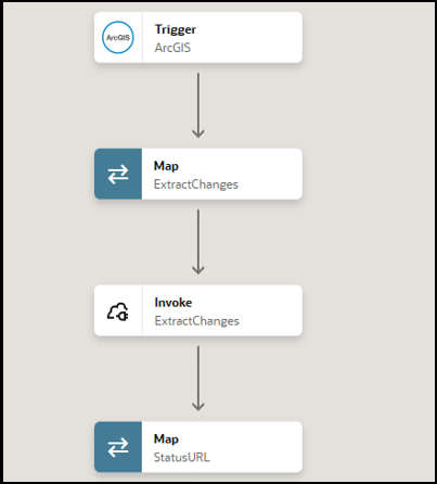
    The first part of the integration shows an ArcGIS (ESRI) Adapter trigger connection, map action, REST Adapter invoke connection, and map action.

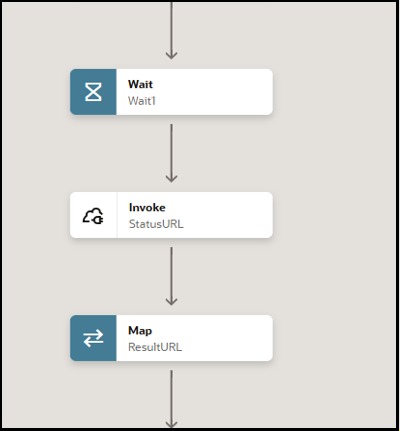
    The second part of the integration shows a wait action, REST Adapter invoke connection, and map action.

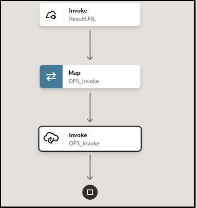
    The final part of the integration shows a REST Adapter invoke connection, map action, and Oracle Field Service Cloud Adapter invoke connection.